StateBook for Site Selection
Data and More Data
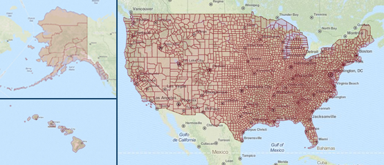
StateBook integrates more than 63,000 data points from over 50 trusted data sources into an efficient, state-of-the-art GIS mapping platform that enables you to instantly filter to the communities nationwide that meet your specific business needs.
Apples to Apples
StateBook also provides the first online platform to compare the specific data points you select across communities nationwide.
Robust Reporting Tools
Our efficient reporting tools enable you to save your map filters and geographic areas of interest, create data templates, meaningful reports, and more.
Confidentially Connect with EDOs
Once you identify communities of interest, StateBook enables you to anonymously and confidentially connect to the economic development organizations (EDOs) representing them to learn more.
Valuable Local Context
You can view StateBook data by county, MSA, or by EDO. In addition, our EDO microsites enable EDOs to complement our StateBook Stats data with their own valuable editorial information, photos and more to provide the most up-to-date information about their local communities, from local tax rates, utility costs and incentives to case studies and quality of life. The data that EDOs enter will also be searchable and comparable, and can be added to your reports to provide important local context.
Sites & Buildings
County, MSA and EDO pages also offer sites and buildings listings, as well as business directories and relevant advertising to connect you to the services you'll need in your new community.
Advertise
To market your services to our community of economic developers and corporations around the world, click here.
Subscribe to access Compare and build custom Reports
Become a paid subscriber to access StateBook’s robust comparison and reporting tools. StateBook’s Compare pages enable you to compare our more than 63,000 data points across communities, use the data to create customized reports and more.
To purchase a subscription, please first Sign In or Register for an account.
Get Started Today
Finding the right communities for your business is easy
- Use robust data on the Map to filter to the communities that best meet your business needs.
- Use the tabs on the Map to select as many data filters as you wish.
- Click on the highlighted counties of interest to see which municipal, county, regional and statewide EDOs represent those communities
- Click on the EDOs of interest to visit their microsites and see local data about their communities
You may also view data on the Map by metropolitan statistical area (MSA), and see data for any community by visiting the County and MSA microsites.
